Eyarth - Work in Progress
THE EYARTH CUTTING EXTENSION
I think I have mentioned elsewhere on this site that I always thought that I might build extensions to the layout if the basic layout turned out well enough. Having completed the first 7 boards and been reasonably happy with the outcome, I recently started work on the first extension – at the Nant Clwyd end of the layout.
I thought it might be interesting to provide occasional updates on my progress, rather than just comment on the finished item afterwards. Its not a blog as such because the updates will only come every month or so but it will be a slightly different way of explaining how I did it.
PLANNING (Nov 2014)
Although the layout is as faithful a representation of the real thing as I could manage, one of the major limitations has been the amount of foreshortening required to fit everything in the space I had available. Even with a small branch line station, the real thing took up much more space that would be available for most modellers. With Eyarth, this is particularly true in the areas between the end of the passing loop and the scenic breaks. This is particularly true at the Nant Clwyd end. Although Eyarth Cutting really did exist, it was actually half a mile or so away from the station, whereas my model has it no more than 50 yards or so away. In addition, between the station and the cutting, the line passes over a small road and over the River Clwyd, using an interesting series of bridges.
So the first extension was aimed at re-creating some of the run from the station to the cutting, including the road and river overbridges.
Although I had done quite a lot of research on the line when I lived in North Wales, there was much less material available in respect of this bridge area than there was of the station area. The material I had to work with was as follows:
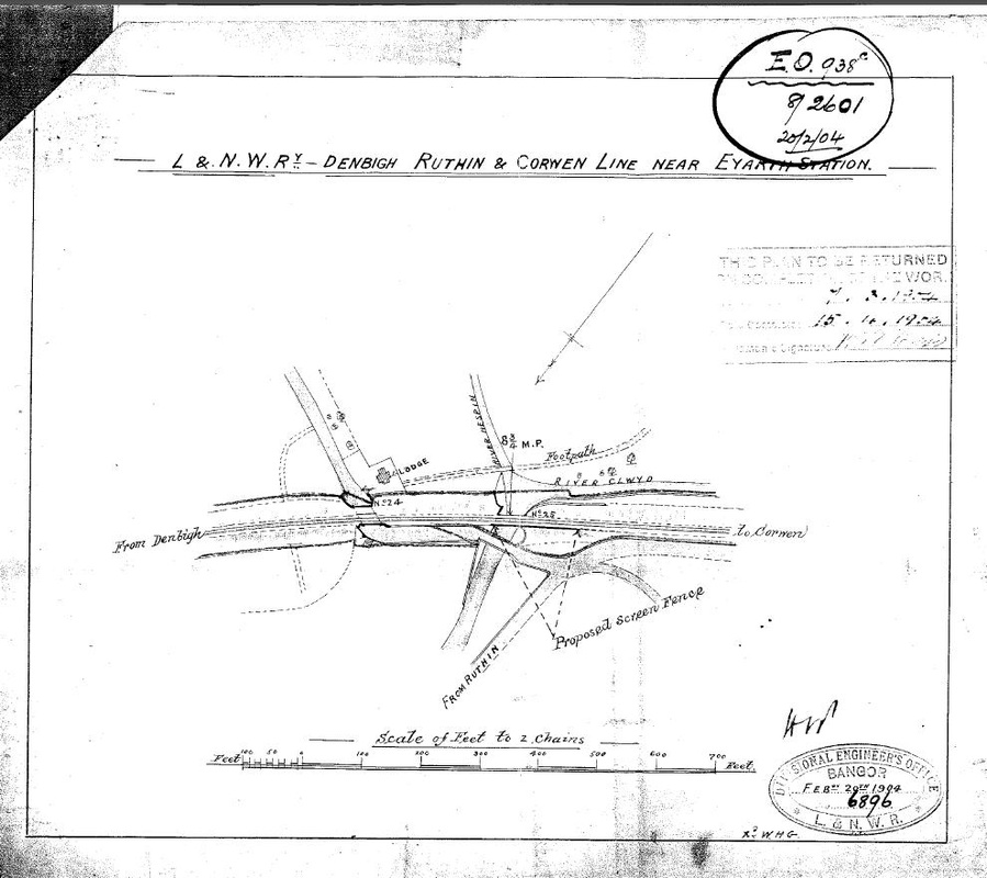
- An
LNWR plan of the area from 1904 that was drawn up as part of a project
to add additional railings to the embankment. This plan gave me a very
good idea of the overall layout of the railway, roads and rivers in
the area, as well as some basic dimensions.
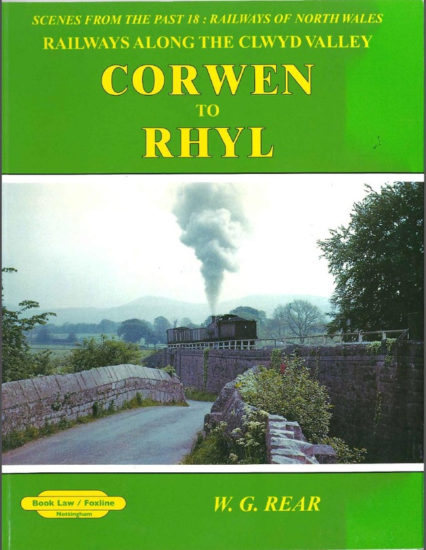
- The
Booklaw Publishing book, “Scenes From the Past 18: Railways of North
Wales, Corwen to Rhyl”, by WG Rear. The front cover of this book is
actually a photograph of a short goods train passing over the road
bridge and gives and very good overall impression of the area. The book
also contains a number of other pictures of the area and although they
are mainly focused on trains, they give some further insight as to
what things looked like.
- Photos
from web page geolocation.ws. These include some of the remaining
earthworks and a nearby cattle creep (which I have included on the
layout). Although taken after closure, they were taken some time ago
and the trees and shrubs had not yet fully taken over, so bridge
parapets and the like are still largely visible.
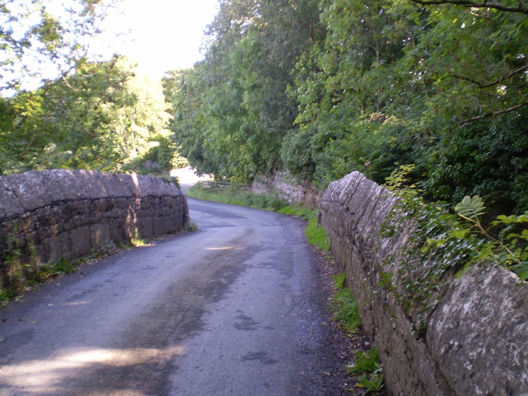
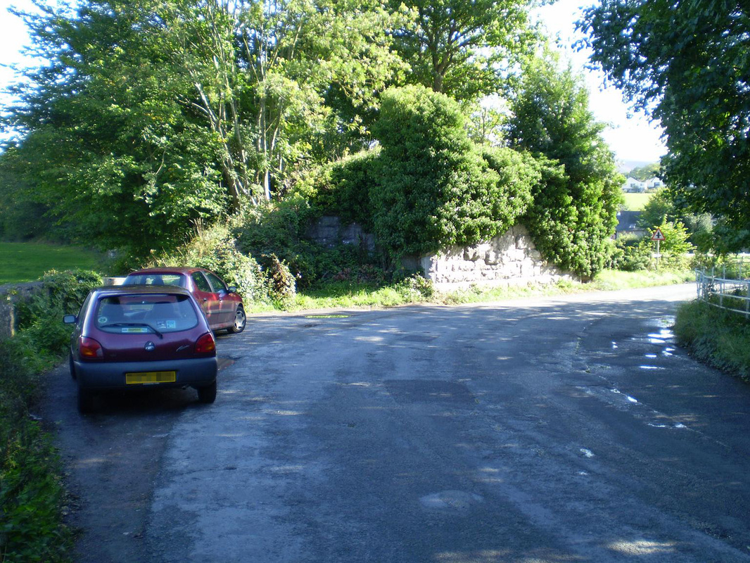
- Photographs taken during a visit to the area in 2009. I have enclosed a couple of examples here.
I find the production of drawings useful as it allows you to establish the gaps in your research materials and requires you to make decisions on dimensions, inclusions and exclusions prior to the cutting of any timber.
For example, although the actual road to Corwen runs very closely to the railway line as it approaches the cutting, I had not modeled the road in my original board of Eyarth Cutting. So to avoid a lack of continuity when I inserted the extension into the main layout, I had to change the direction of the road once it crossed the river.
Next update will be on baseboard construction…..
